Draft Submission Plan (Regulation 19)
Balsall Common Comment
The Settlement Now
481.Balsall Common is largely a post-war suburban town bisected by the A452 which links east Birmingham, the NEC and Birmingham airport with Kenilworth and beyond to the south-east. It is located in the ‘Meriden Gap’ just 2km from the boundary with Coventry[40]. Comment
482.The settlement straddles the parish boundary between Balsall & Berkswell parishes, with most of the settlement being located within Balsall parish. Beyond the main settlement are the smaller villages of Berkswell and Temple Balsall; both of which have primary schools but otherwise only a very limited range of facilities. The population of the town is around 7,000 in some 2,900 households. Comment
483.The settlement is characterised by popular, low density residential areas with an open plan, cul-de-sac style layout. It has a small but thriving local centre astride the A452 with a range of shops, facilities and services, although there are some opportunities to improve the Centre. A recently constructed medical centre is located on the northeast side of the settlement. Comment
484.The Heart of England secondary school (which accommodates around 1,200 pupils) is located in the settlement, as is Balsall Common Primary School which has three forms of entry. Its restricted location together with its size does result in congestion around school drop off/pick up times. Berkswell CE Primary School is located around 1km north of the settlement. Comment
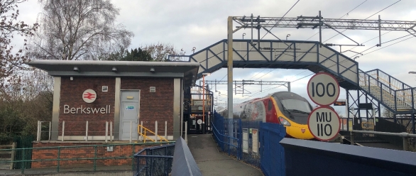
485.Berkswell railway station to the north-east of the town provides access to London, Birmingham and Coventry via the West Coast mainline. It has a small car park which fills up rapidly in the morning with commuter parking resulting in overspill parking in roads nearby. Comment
486.The Berkswell Neighbourhood Plan and Balsall Neighbourhood Plan were formally ‘made’ by the Council in September 2019 and June 2021 respectively. Comment
The Settlement in the Future
487.Balsall Common is one of two rural towns in the Borough that has a full range of facilities including both secondary & primary schools, health services and a range of retail and associated facilities. As such it is well placed to accommodate levels of growth in excess of just its own local needs. Comment
488.Although Balsall Common is of a size that caters for many residents’ day-to-day needs, it does not have significant areas of employment uses, other than service uses. Many of the area’s economically active residents travel beyond the settlement for employment. The Jaguar Land Rover vehicle operations base and test track is located to the south of Balsall Common at Fen End. Comment
489.The A452 will continue to provide an important part of the highway network enabling vehicles to travel from Kenilworth and beyond up towards east Birmingham (including the UKC Solihull Hub area). The road carries much through traffic (e.g. over 80% of traffic passes through the village during the am peak time without stopping) and now is the opportunity to use new development to complete the highway network so that there is a functioning by-pass enabling through vehicles to avoid using the village centre. This in turn will allow for environmental improvements (including cycle lanes) to be undertaken along the Kenilworth Road within the village as it would no longer need to accommodate the same levels of through traffic. Comment
490.The HS2 rail link enters the Borough in the southeast corner of Berkswell parish and for this initial stretch it uses the line of the Greenway (the now disused rail link to Kenilworth) before reaching the west coast main line. Here the HS2 line crosses over the existing rail line (just to the south of Berkswell station) and continues north westwards on a line roughly parallel to the west coast mainline before entering Hampton in Arden. To accommodate the crossing of the existing rail line, the new high-speed line will necessitate the construction of a viaduct some 250m long and 10m high. Initial enabling works in the vicinity of Balsall Common commenced in January 2019. During this period there will be a focus of construction traffic in and around the Balsall Common area as many vehicles will access the construction zones having travelled southeast along the A452 from the A45 and into the settlement. Comment
What is Required for the Settlement in the Future?
491.Development in and around the settlement is not only an opportunity for it to play a major part in accommodating Borough needs, but also to accommodate a scale of development that is capable of supporting significant infrastructure provision that can help play a part in dealing with existing issues and provide the necessary facilities for future residents. In particular the following areas have been identified and should be taken forward: Comment
492.Balsall Common Relief Road – Evidence shows that there is a need for a bypass to serve Balsall Common currently, and that the additional growth proposed in this Plan will make its delivery necessary to facilitate development and HS2 activity. It also indicates that continuing the line of Hall Meadow Road around the eastern side of the village, crossing Waste Lane to the west of Little Beanit Farm and joining up with the A452 around the Meer End Road junction is the preferred route. Comment
493.The delivery of the relief road continues to be supported by the Council as part of a multi modal package of works, with the relief road coming forward in 3 parts and a fourth part capturing changes to the Kenilworth Road through the centre of the town: Comment
- Phase 1 would see the upgrade of Hallmeadow Road.
- Phase 2 would provide a new section of road between Station Road and Waste Lane, to be delivered as part of the Barretts Farm development.
- Phase 3 would include a new section of road between Waste Lane and Kenilworth Road.
494.The design of the road would be single carriageway with direct access points minimised thus being attractive to through traffic as an alternative to using Kenilworth Road through the centre. However, the road would be expected to provide the main vehicular access into the Barratt’s Farm development as well as any development brought forward as part of the Broad Location for Growth identified as part of Phase 3. Delivery of the road will comprise of direct on-site delivery; financial contributions coupled with potential CIL funding; and grant funding opportunities that may be available through, for instance, the WMCA. Comment
495.In March 2025 the Council adopted the Balsall Common Multi Modal Transport Package (MMP) Position Statement as a material planning consideration, and this included how a proportional contribution towards its delivery would be calculated in relation to new developments. Comment
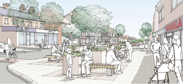
496.An Enhanced Centre – Although the centre provides for a range of retail services, the level of growth proposed provides an opportunity for additional residents to support new facilities. Furthermore, the environmental improvements along Kenilworth Road made possible through the provision of a by-pass will also provide a catalyst for enhancements to the centre. Most of the centre is located within Balsall parish, but areas in Berkswell may also be included. In February 2022, Balsall & Berkswell Parish Councils published a Balsall Common Centre Master Plan which includes details on how the centre could be enhanced. Comment
497.Station Parking – The northern part of the Barratt’s Farm development can be used to provide parking facilities for station users. This would be a short walk from the station and would seek to address the issue over commuter parking. Comment
498.Improved Public Transport – A higher population gives greater potential for improved public transport services to be viable, e.g. better frequency of bus services and as HS2 starts to operate, the existing main line has the potential to provide for greater local commuter services. Comment
499.New Primary School – Based on the sites allocated for development, a new two form entry primary school, including early years provision, is to be accommodated on the Barratt’s Farm development. Funding for the school will be expected via developers’ contributions associated with the development of the allocated sites. Further development around broad locations may also add provision for a further primary school. Comment
500.Secondary School – Heart of England School is located in Balsall Common but serves a far wider area, including a significant number of pupils living outside of Solihull. The school will be able to cater for pupils from some of the proposed developments from within its existing capacity, however expansion of places will be required at the school and should be funded through developers’ contributions Comment
501.Sports and Recreation - It has been identified that a sports hub to serve the new development in and around the settlement should be provided. This is set out under policy SMBC/D2. Comment
502.Green Space Improvements – In accordance with the NPPF and the ‘golden rules’, opportunities for the provision and improvement of local green space that is accessible and of high quality will be maximised. Comment
503.Health provision – The Council is working with the BSOL ICB to establish the impact of new development on local GPs and other services, and how this can be addressed. Comment
504.Community Infrastructure Levy – Both parish Councils that cover the area have a Neighbourhood Plan in place, and so will receive 25% of the levies received in the area. This will provide a significant source of funding that can be used to take forward appropriate projects that the community have identified as priorities. This can include simple relatively low-cost actions (e.g. further traffic regulation orders) through to more substantial projects. It will be for the parish council to decide how this ‘local’ element of the CIL receipts is to be spent and there is potential for partnership working to maximise the use of monies from this source. Comment
Proposed Approach
505.Whilst Balsall Common is identified for significant housing growth it will be important that future development is managed to respect its relationship to neighbouring settlements, especially the historic village of Berkswell to the Northeast. The settlement has a broad range of facilities including the rail station with links to Birmingham, Coventry and the UK Central Solihull Hub Area, schools, medical practice, library, retail and recreational facilities. The HS2 rail line will form a significant barrier on the east side of the settlement. Comment
506.The Green Belt boundary around Balsall Common will need to be amended to accommodate the level of growth proposed for the settlement. To provide a logical, strong and defensible new eastern boundary it is proposed to use the west coast mainline[41] as the new boundary from where Kenilworth Road crosses the line to the north of the settlement to the point the HS2 line crosses the existing railway just to the south of Station Road; then the line of HS2 will be used as the boundary to the point where it crosses Waste Lane. Thereafter the boundary will be drawn close to the eastern edge of site BC4 before following the line of Windmill Lane to the southern point of site BC3 where it then cuts across to Kenilworth Road. Development opportunities through the ‘call for site’ process within this line will form the basis for the bulk of the allocated sites. Comment
507.A mix of market and affordable housing, as well as smaller market homes for young people wishing to remain in the area and specialist housing to meet the needs of older people will be provided in the settlement. This will seek to align the types and sizes of homes to be made available and the needs of the community. However, there will need to be a careful balance struck between making the most efficient use of land and respecting the character of the local area. Comment
Recent Planning Applications
508.A number of recent planning applications need to be highlighted as they are relevant to how the settlement will develop in the future, and they will have implications for determining what an appropriate amended boundary to the Green Belt ought to be. The proposals include the following: Comment
Development of up to 1,060 dwellings at Barratt’s Farm.
509.A resolution to grant outline planning permission for part[42] of this Green Belt site that was an allocation in the 2020 plan known as BC1 has now taken place. This will accommodate up to 970 dwellings, new local centres and new care provision. Comment
510.A further application for a smaller part of the former allocation has been submitted but not yet determined. This relates to up to 90 units off Oxhayes Close[43] with the site sitting between the existing urban area and the wider Barretts Farm development proposal. Comment
511.As planning permission is likely to be granted at Barretts Farm before this plan is adopted and there is no evidence to suggest that the permission will not subsequently be implemented, it is appropriate that the Green Belt boundary around this part of the settlement be amended so that the new dwellings do not (needlessly) remain in the Green Belt. Using strong physical features that are readily recognisable and are likely to remain permanent, the new Green Belt boundary will be formed by Station Road, the HS2 line and Waste Lane. Comment
Development of up to 110 dwellings at Frog Lane[44].
512.Outline planning permission has been granted for this Green Belt site that was an allocation in the 2020 plan known as BC2. Comment
513.As planning permission has been granted, and there is no evidence to suggest that the permission will not be implemented, it is appropriate that the Green Belt boundary around this part of the settlement be amended so that the new dwellings do not (needlessly) remain in the Green Belt. Using strong physical features that are readily recognisable and are likely to remain permanent, the new Green Belt boundary will be formed by Frog Lane. Comment
Development of up to 268 dwellings on land south of Waste Lane[45].
514.Detailed consents[46] have been granted for this Green Belt site that was an allocation in the 2020 plan known as BC4. Comment
515.As planning permission has been granted, and there is no evidence to suggest that the permission will not be implemented, it is appropriate that the Green Belt boundary around this part of the settlement be amended so that the new dwellings do not (needlessly) remain in the Green Belt. There is no strong physical feature that is readily recognisable to form the eastern boundary of the land to be removed from the Green Belt and therefore field boundaries have been used as the new Green Belt boundary. Comment
Development of up to 95 dwellings at 722 Kenilworth Lane[47].
516.Outline planning permission has been granted (on appeal) for this Green Belt site that wasn’t an allocation in the 2020 plan. Comment
517.As planning permission has been granted, and there is no evidence to suggest that the permission will not be implemented, it is appropriate that the Green Belt boundary around this part of the settlement be amended so that the new dwellings do not (needlessly) remain in the Green Belt. There is no strong physical feature that is readily recognisable to form the eastern boundary of the land to be removed from the Green Belt and therefore field boundaries have been used as the new Green Belt boundary. Comment
Development of 37 dwellings on land west of Hob Lane[48].
518.Full planning permission has been granted for this Green Belt site that wasn’t an allocation in the 2020 plan. Comment
519.As planning permission has been granted, and there is no evidence to suggest that the permission will not be implemented, it is appropriate that the Green Belt boundary around this part of the settlement be amended so that the new dwellings do not (needlessly) remain in the Green Belt. There is no strong physical feature that is readily recognisable to form the eastern boundary of the land to be removed from the Green Belt and therefore field boundaries have been used as the new Green Belt boundary. Comment
Previous Allocations
Policy SMBC/BC3: Windmill Lane/Kenilworth Road Comment
- The site is allocated for 132 dwellings
- Development of the site should include:
- Provision of low-density housing, and where relevant single storey housing, to protect the setting and functionality of Berkswell Windmill.
- Provision of public open space and a range of play areas for children and young people in accordance with the Open Space Assessment and future revisions.
- Enhancement of public rights of way through the site as a pedestrian route and key green infrastructure link.
- Trees and hedgerows along to be retained.
- 5% of open market dwellings to be provided in the form of Self and Custom Build Plots in accordance with Policy SMBC/HO4.
- Provision of above ground SuDS features.
- Likely infrastructure requirements will include:
- Developer contributions to education provision.
- Developer contributions to primary and secondary care health services in conjunction with Birmingham and Solihull Integrated Care Board (BSOL ICB).
- A proportionate contribution towards the Balsall Common Multi Modal Package (incorporating the Balsall Common Relief Road) calculated in accordance with the Council’s March 2025 Position Statement.
- Appropriate measures to promote and enhance sustainable modes of transport including pedestrian and cycle connectivity towards Berkswell rail station, Balsall Common centre and Balsall Common health centre.
- Avoidance of flood risk areas to north –west of site and potential for flood alleviation measures to benefit the wider area;
- Financial contribution to provision of new playing pitches and contributions to enhancement of existing recreational facilities, to accord with the requirements identified in the Playing Pitch Mitigation Strategy.
520.This site is bounded by the settlement edge to the north and Kenilworth Road and Windmill Lane as far south as the existing development allocated in the SLP 2013. In the Draft Local Plan and Supplementary Consultation undertaken for the 2020 plan, this site was proposed for 200 dwellings. Evidence has indicated that this level of development would have a significant adverse impact on the ecological quality of the site and the setting of the adjacent heritage asset, Berkswell Windmill. As a result, the capacity has been significantly reduced and the southern part of the site excluded from development. Comment
521.Although the site is located a greater distance from the centre of the settlement than others, this did not prevent the SLP Inspector concluding that the area was not so remote that it would justify the omission of the two sites in this parcel brought forward under the SLP 2013. The proposed allocation now extends no further south than the existing housing. Comment
522.In Green Belt terms the parcel performs moderately. At least in part this is due to the development and encroachment that has already taken place in the parcel. The site is located in an area with low capacity to accommodate change in the Landscape Character Assessment, 2016. Comment
523.The Heritage Impact Assessment[49] for Site BC3 identifies potential harm to the setting of the Grade II* Berkswell Windmill and recommends mitigation by leaving undeveloped the paddocks adjacent Windmill Lane and any areas where development would adversely affect the functionality of the Windmill or the view cone from the south-west. Evidence from the Berkswell Mill Wind Flow Study 2019 indicates that the parts of the site closest to the Windmill would be subject to significant height constraints. Excluding the southern part of the site, protecting areas of ecological value and restricting the height of development where necessary elsewhere will ensure that the development does not result in harm. Comment
Policy SMBC/BC5: Trevallion Stud Comment
- The site is allocated for 310 dwellings
- Development of the site should include:
- Provision of public open space and a range of play areas for children and young people in accordance with the Open Space Assessment and future revisions.
- Trees and hedgerows along to be retained.
- 5% of open market dwellings to be provided in the form of Self and Custom Build Plots in accordance with Policy SMBC/HO4.
- Provision of above ground SuDS features.
- Likely infrastructure requirements will include:
- Developer contributions to education provision.
- Developer contributions to primary and secondary care health services in conjunction with Birmingham and Solihull Integrated Care Board (BSOL ICB).
- A proportionate contribution towards the Balsall Common Multi Modal Package (incorporating the Balsall Common Relief Road) calculated in accordance with the Council’s March 2025 Position Statement.
- Appropriate measures to promote and enhance sustainable modes of transport including pedestrian and cycle connectivity towards Berkswell rail station, Balsall Common centre and Balsall Common health centre.
- Financial contribution to provision of new playing pitches and contributions to enhancement of existing recreational facilities, to accord with the requirements identified in the Playing Pitch Mitigation Strategy.
524.This site is focussed on the land associated with the stud farm, but it also includes some adjacent parcels, much of which is previously developed and included on the BLR. The area to be removed from the Green Belt would be that bounded by Kenilworth Road and Wootton Green Lane. It would use strong, defensible boundaries to establish the extent of the Green Belt. Comment
525.Although this is in a wider parcel assessed in the Green Belt Assessment (2016) as making a strong contribution to Green Belt purposes, it is considered that due to the presence of built development and encroachment in this part of the parcel that this smaller area actually performs less well in its own right. A large part of this area is included on the Council’s BLR. Comment
526.The site is located in an area with very low capacity to accommodate change in the Landscape Character Assessment, 2016, although as it is substantially brownfield, its contribution to the character of the landscape area is more limited. It has overall medium accessibility, with very high accessibility to a food store. Comment
Policy SMBC/BC6: Lavender Hall Farm Comment
- The site is allocated for 92 dwellings
- Development of the site should include:
- Provision of public open space and a range of play areas for children and young people in accordance with the Open Space Assessment and future revisions.
- Trees and hedgerows along to be retained.
- Facilitating easy access by walking and cycling to the rail station and other facilities,
- Provision of above ground SuDS features.
- Protection of the setting of heritage assets adjacent the site.
- Provision of a buffer between new housing and both the existing railway line and HS2.
- Likely infrastructure requirements will include:
- Developer contributions to education provision.
- Developer contributions to primary and secondary care health services in conjunction with Birmingham and Solihull Integrated Care Board (BSOL ICB).
- A proportionate contribution towards the Balsall Common Multi Modal Package (incorporating the Balsall Common Relief Road) calculated in accordance with the Council’s March 2025 Position Statement.
- Appropriate measures to promote and enhance sustainable modes of transport including pedestrian and cycle connectivity towards Berkswell rail station, Balsall Common centre and Balsall Common health centre.
- Financial contribution to provision of new playing pitches and contributions to enhancement of existing recreational facilities, to accord with the requirements identified in the Playing Pitch Mitigation Strategy.
527.This site is focussed on the previously developed land part of the site that sits behind Lavender Hall Farm itself, to the north-west of the fishing lakes. Comment
528.Although the site sits in a strongly performing broad area parcel within the Green Belt Assessment, 2026 the HS2 line will provide a new feature separating the site from the wider Green Belt that will remain to the northeast. It is considered that, due to the presence of built development and encroachment in this part of the parcel, this smaller area actually performs less well in its own right. A large part of this area is included on the Council’s BLR. Comment
529.The site is located in an area with very low capacity to accommodate change in the Landscape Character Assessment, 2016, although as it is brownfield, its contribution to the character of the landscape area is more limited. It has medium high accessibility, with footpath access to the rail station and medical practice. Comment
SLP Site 19 – Riddings Hill/Hallmeadow Road (capacity 65)
530.The adopted Solihull Local Plan (2013) allocated this 1.6ha site off Hallmeadow Road/Riddings Hill for development of approximately 65 dwellings. The 2013 amended the Green Belt boundary to accommodate this site and the wider changes to Green Belt boundaries around the settlement noted above will also see the adjacent heath centre being removed from the Green Belt. Comment
531.As the 2013 plan will fall away when this plan is adopted, it is considered necessary to include an allocation policy for this site as follows. Comment
Policy SMBC/BC7: Hallmeadow Road/Riddings Hill Comment
- The site is allocated for 65 dwellings
- Development of the site should include:
- Provision of public open space and a range of play areas for children and young people in accordance with the Open Space Assessment and future revisions.
- Provision of above ground SuDS features.
- Likely infrastructure requirements will include:
- Developer contributions to education provision.
- Developer contributions to primary and secondary care health services in conjunction with Birmingham and Solihull Integrated Care Board (BSOL ICB).
- A proportionate contribution towards the Balsall Common Multi Modal Package (incorporating the Balsall Common Relief Road) calculated in accordance with the Council’s March 2025 Position Statement.
- Appropriate measures to promote and enhance sustainable modes of transport including pedestrian and cycle connectivity towards Berkswell rail station, Balsall Common centre and Balsall Common health centre.
- Financial contribution to provision of new playing pitches and contributions to enhancement of existing recreational facilities, to accord with the requirements identified in the Playing Pitch Mitigation Strategy.
532.The Green Belt boundary was adjusted in the 2013 plan to accommodate this site, and as such it can be considered as ‘white land’, i.e. land with no policy designation. No policy changes are required in this plan to bring the site forward. Comment
533.This Council owned site has recently been marketed, and the Council is seeking to dispose of its interest to a housing developer. Comment
Broad Locations[50]
534.Four broad locations for growth have been identified for Balsall Common alongside one notable site within the SHELAA. These are reflective of known development pressures and site opportunities promoted through the call for sites and informed by national policy. These include: Comment
BC8 - Land West of Lavender Hall Lane and South of Park Lane.
535.This area is currently in use as an HS2 depot. The timetable for release of the land remains under discussion with HS2 however with the known operating window for HS2 now expected by 2039 there is scope for the delivery of homes within this area within the later years of the Plan period, especially if the existing site is released earlier. This site is considered predominately brownfield land within the Green Belt and would be expected to meet the requirements of Policy SMBC/D1 terms of comprehensive masterplanning) and NDMPs GB7(g) and GB8. The opportunity to deliver c400 homes within this site is referenced within the SHELAA housing land supply (and is included in row 3 of the land supply table in the Housing chapter). Comment
BC9 - Land at Phase 3 of the Balsall Common Relief Road.
536.The delivery of the new relief road to the south and east of Balsall Common will create a new defensible boundary to the south of the town between Waste Lane and Kenilworth Road. This section of the relief road (known as phase 3) remains subject to ongoing technical development work to confirm its final alignment. The Council will continue to work with landowners, the parish councils and other respective stakeholders to bring forward a comprehensive development within this broad location that will help accelerate the delivery of phase 3 of the relief road. The future amendment of Green Belt boundaries in this location will be confirmed through one of the following 3 mechanisms: Comment
- The next review/update of the Councils local plan;
- an update to the respective Neighbourhood Plan; or
- A new Supplementary Plan brought forward under the new planning system.
537.In the interim period, any development proposals within this broad location will be considered on their own merits. They should however be considered in the context of a comprehensive masterplan approach (having regard to policy SMBC/D1). The Council is of the view that the delivery of the relief road in this location would constitute appropriate development within the Green Belt (in accordance with NDMP GB7 (1)(f)(i)) as it would be considered essential transport infrastructure requiring a current Green Belt location. In accordance with the principles of this broad location for growth however, the Council considers that the delivery of the relief road (either in part or full) would constitute a Very Special Circumstance to be weighed as part of a respective planning application. Any development brought forward within this broad location would also need to give careful consideration to existing properties and the setting of the Grade II* Berkswell Windmill. Comment
BC10 - Land around Berkswell Railway Station
538.NDMPs S5 (1)(h): Principle of development outside settlement and GB7 (1)(h) Development which is not inappropriate in the Green Belt, now support development within reasonable walking distances of railway stations and as such development consistent with these national policies can be expected to come forward in this settlement. This will include development around Berkswell station and as such it is included as a broad location in this plan. Comment
BC11 - Land around Tile Hill Railway Station
539.NDMPs S5 (1)(h): Principle of development outside settlement and GB7 (1)(h): Development which is not inappropriate in the Green Belt, now support development within reasonable walking distances of railway stations and as such development consistent with these national policies can be expected to come forward in this settlement. This will include development around Tile Hill station and as such it is included as a broad location in this plan. Comment
540.Although Tile Hill station is located within Coventry, it is located close to the Borough boundary such that parts of Solihull Borough are within a reasonable walking distance of the station, and thus it is included as a broad location. Comment
[40] And it is noted that there have been and will be further developments in Coventry on its western outskirts close to the Borough boundary.
[41] With the exception of that part of the line adjacent to Lavender Hall Farm. At this point the Green Belt boundary would extend north-eastwards beyond the railway line so that DLP site 21 (r/o Lavender Hall Farm) can be included as an allocation.
[42] This relates to the majority of the site and is included under reference 2023/01520
[43] Planning application reference 2023/00693
[44] Planning application reference 2023/02248.
[45]Planning application reference 2023/02214.
[46]The wider allocation has come forward in two parts, namely the larger Pheasant Oak Farm area (applications 2023/02214 and 2026/00479 for 250 dwellings) and a smaller part of the site in the NW corner known as Catchams’ Corner (applications 2023/02281 and 2025/01422 for 17 dwellings).
[47]Planning application reference 2021/01360
[48] Planning application reference 2025/00092.
[49] Undertaken for the 2020 plan.
[50] See Policy SMBC/HO2: Broad Locations for the policy wording relating to these areas.
