Draft Submission Plan (Regulation 19)
Knowle, Dorridge & Bentley Heath Comment
The Settlement Now
636.Lying around 3 miles southeast of Solihull Town Centre, Knowle, Dorridge and Bentley Heath (KDBH) is a town with a combined population of around 19,300 in some 7,900 households. It is inset in the Green Belt which separates it from the main urban area of Solihull and the surrounding rural villages. Comment
637.Whilst Knowle, Dorridge and Bentley Heath are essentially three communities, the significant post-war development in the area means that they are now physically and functionally linked such that they form one built up area. Reflecting this relationship and the scale of the settlement, the Council identified Knowle, Dorridge and Bentley Heath as a town in October 2025. It is not obvious where one area ends and another one begins and there are strong links between each community as they share many local services and facilities. However, each area has its own shopping provision, park, primary school, community/village hall and churches which help to underpin the sense of individual identity. Comment
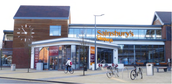
637.The historic medieval core of Knowle is centred on the High Street and the church of St. John the Baptist, St. Lawrence and St. Anne, at the junction of two historic routes. This area is protected by Conservation Area designation and includes 53 statutory listed buildings and a number of locally listed assets. Knowle has a thriving and well used local centre with an extensive range of shops, facilities and services. Comment
638.Similarly, development from the later Victorian and Edwardian periods around and near to Dorridge railway station (Station Approach and Granville Road) also benefit from Conservation Area status. The shopping parade in Dorridge provides up-dated modern facilities and a public realm that enhances the centre as a whole. It includes food and drink outlets, small business, shops and services. Comment
639.Bentley Heath has a smaller range of shops and services providing more for the day-to-day convenience needs of residents. Comment
640.Overall, the settlement benefits from an attractive residential environment with leafy green streets, access to a number of parks, open spaces and green spaces within the area, and links to the countryside beyond. Green and blue infrastructure is a valuable attribute, with local wildlife sites and local nature reserves, as well as the canal which provides an important environmental and recreational feature. Comment
641.KDBH is served by four primary schools (including a Catholic primary school) and the Arden Academy and Sixth Form Centre secondary school which has a current capacity of around 1,800 pupils. However, the recent housing developments in the area along with a fluctuating birth rate, is impacting school places. Comment
642.The area is valued by residents for the wide range of community services and facilities that are enjoyed and used extensively. These include Knowle Library, Knowle and Dorridge scout huts, sports and recreation facilities, local allotments and commercial premises such as post offices, chemists and public houses that are a vital part of village life. The settlement is also well served in terms of health facilities with 3 GP surgeries and 5 dental surgeries. Comment
643.The settlement as a whole has a high proportion of detached dwellings and low-density residential development is a characteristic of some parts of the settlement. House prices are amongst the most expensive in the Borough and affordability continues to be an issue for those seeking access to housing, as does the need to provide a more appropriate range of housing types and sizes to meet future needs. Comment
644.The area has good links to key employment sites at Blythe Valley Park and Solihull Town Centre. The northwest of the settlement is crossed by the M42 with junction 5 providing access to the motorway network. The main A road through the area is the A4141 running from Solihull through Knowle, on to Chadwick End and out of the Borough towards Warwick. Comment
645.The settlement is reasonably well served by public transport with bus services running throughout the area with routes to Solihull, Balsall Common and Coventry. Regular train services from Dorridge Station provide links to Kidderminster, Solihull, Birmingham, Leamington Spa and London. However, whilst Dorridge Station car park can accommodate over 100 vehicles, this well used station quickly reaches capacity in the mornings with commuter parking resulting in overspill parking in residential roads nearby. This also affects the availability of parking for local shoppers. Comment
646.In April 2019 the Knowle, Dorridge and Bentley Heath Neighbourhood Plan was ‘made’ by the Council. It is therefore part of the statutory Development Plan for Solihull and sets out the objectives and vision for the area as it develops in the future. The Neighbourhood Plan is currently undergoing an update which is not expected to change the nature of the plan. Therefore, further development within the Neighbourhood Area will be expected to support the vision and objectives, and planning applications should be in accordance with the relevant policies of the Neighbourhood Plan, where there is no conflict with the Local Plan. Comment
The Settlement in the Future
647.Knowle, Dorridge and Bentley Heath is one of two rural towns in the Borough that has a full range of facilities including both secondary & primary schools, health services and a range of shops, services and facilities. As such it is well placed to accommodate growth in excess of just its own local needs. Given that the area is mainly residential, the opportunities to develop on previously developed land in KDBH are extremely limited and Green Belt release around the settlement has been required to accommodate new development. However, maintaining separation of KDBH from Solihull and other settlements will continue to be important to preserve the character and context of the town. Comment
648.Although the settlement does not have significant areas of employment uses (other than service uses) and many of the area’s economically active residents travel out to work, there is good access to the motorway and wider road network. Whilst the main road through the centre of Knowle will continue to provide an important link in this regard, it can be congested at peak times and is likely to experience increased vehicle movements in the future, in any event. Given that the historic medieval core of Knowle is centred on the High Street and is protected by conservation area status, it will be important to mitigate congestion in this area in order to maintain the character of this part of the settlement. Similarly, other roads in the area such as Station Road, principally around school drop off and pick up times, see the free flow of traffic interrupted and notable parking difficulties. Opportunities will be explored to consider how these issues can be alleviated. Comment
649.The area is however served by public transport, and it will be important to retain and where possible improve the public transport offer. Dorridge railway station will continue to provide an important facility for local commuters. Opportunities for enhancing existing walking and cycling routes and creating new routes will continue to be explored, particularly where these would provide access to schools, local centres and the railway station. Comment
650.It will also be important to ensure that the local centres remain economically strong, vibrant and continue to provide, support and enhance the variety of services and facilities for the local population. Comment
651.The historic core of Knowle will continue to be protected and enhanced and the local character and distinctiveness of the settlements conserved, particularly, the Victorian and Edwardian development around Dorridge railway station. Comment
652.A mix of market and affordable housing, as well as smaller market homes for young people wishing to remain in the area and specialist housing to meet the needs of older people will be provided in the settlement. This will seek to align the types and sizes of homes to be made available and the needs of the community. However, there will need to be a careful balance struck between making the most efficient use of land and respecting the character of the local area. Comment
653.Education facilities in the area will remain successful. Pressure on primary schools created by new development will be alleviated through the provision of an additional primary school and secondary school facilities will be significantly improved to ensure that the available capacity and full potential of the Arden Academy can be maximised. Comment
What is Required for the Settlement in the Future?
654.Development in and around KDBH is not only an opportunity for the settlement to play a part in accommodating the wider needs of the Borough, but also to accommodate a scale of development that is capable of supporting infrastructure provision that can help play a part in dealing with existing issues and provide the necessary facilities for future residents. In particular the following areas are identified: Comment
655.Improved Public Transport – A higher population gives greater potential for improved public transport services to be viable, e.g. better frequency of bus services. Comment
656.Parking Improvements – The provision of appropriate additional off-street parking may be considered in centres. In addition, decked parking at Dorridge railway station could be considered in order to increase capacity and alleviate the impact of commuter parking on surrounding roads. Options to provide park and ride facilities will also be encouraged where appropriate. Comment
657.Highway Improvements – Traffic in the settlement is set to increase over the Plan period, even without any new development. Additional traffic growth as a result of site allocations is likely to exacerbate this situation and highway improvements will be required at various locations. Approvals or resolutions to grant permission have included both site-specific highway works and financial contributions towards wider transport improvements set out in the Knowle Transport Study. This study will be updated and expanded to have regard to possible wider impacts across Dorridge and Bentley Heath as well as Knowle. Comment
658.Pedestrian and Cycling Connectivity – Enhancements to encourage and promote walking and cycling in the settlement, particularly towards the local centres, schools and public transport will be required. Developments will be expected to ensure that walking and cycling connectivity is provided both within and beyond the site boundary, linking in with the existing and proposed cycle and walking networks identified in the Council’s Cycling and Walking Strategy, as well as routes for recreation. Comment
659.New Education Provision – Given the additional pressure for school places that will be generated as a result of further development in the settlement, a new primary school will be required in Knowle. Whilst the provision of secondary school places is theoretically sufficient to meet existing demand, the current infrastructure constraints of Arden Academy affect how efficiently it can be used in the future. The academy has a largely ageing built estate (particularly its supporting infrastructure (including kitchen/dining space and other supporting facilities)) and an undersized site relative to current DfE standards. The school is part of the Government’s School Rebuilding Programme and any additional growth within the settlement is likely to place further pressure on demand for school places. Comment
660.As part of the development proposals on land south of Knowle (also known as site KN2 in the previously withdrawn 2020 Local Plan), land will be made available for the wider redevelopment of Arden Academy to maximise its potential and allow for future expansion if this proves necessary. Additional primary school provision is also required to support the level of growth in the settlement and developer contributions will be expected to deliver this. Land has been made available for a primary school site on land formerly known as KN2 as part of an outline planning permission for 450 dwellings. Comment
661.Play and Open Space – Provision of play and areas of open space within potential development sites will be required. There is also a need to ensure that best use is made of existing green and blue infrastructure assets within development sites, together with provision for linkages to the surrounding area. Comment
662.Sport and Recreation – Replacement of any lost recreation / sports provision as a result of development will be required to an equivalent or better standard, including access and use by the wider community where appropriate. It has been identified that a sports hub to serve the new development in and around the settlement should be provided. This is set out under policy SMBC/D2. Comment
663.Green Space Improvements – In accordance with the NPPF and the ‘golden rules’, opportunities for the provision and improvement of local green space that is accessible and of high quality will be maximised. Comment
664.Health provision – The Council is working with the BSOL ICB to establish the impact of new development on local GPs and other services, and how this can be addressed. Comment
665.Community Infrastructure Levy – As the area is covered by ‘made’ Neighbourhood Plan, 25% of the levy collected will be spent in the area. The Local Authority will engage with the local community and agree with them how best to spend the funding, which could be used to take forward appropriate projects that the community have identified as priorities through the Neighbourhood Plan for example. This can include simple, relatively low-cost actions (e.g. further traffic regulation orders) through to more substantial projects. Comment
666.Affordable Housing and Smaller Market Homes – Affordable housing will be required on development sites (in accordance with the Local Plan) and smaller market homes for younger people wishing to stay in the area will be sought. Comment
Proposed Approach
667.Knowle, Dorridge and Bentley Heath is a town identified for expansion. Given that the opportunities to develop on previously developed land in KDBH are extremely limited, Green Belt release will be required, and a redefined Green Belt boundary will need to be established. In accordance with national planning policy, such boundaries should be defined clearly, using physical features that are readily recognisable and likely to be defensible. Sites that are close to the existing settlement or are / can be well-served by public transport will be preferable, subject to their performance against the purposes in evidence base and constraints. Comment
668.Sites where there are multiple and potentially complex land assembly issues and sites where the cumulative impacts of their development will impact the settlement will need to be considered collaboratively and comprehensively to ensure a quality development is delivered and that contributions are made to the provision of the required infrastructure. Comment
Recent Planning Applications
669.A number of recent planning applications need to be highlighted as they are relevant to how the settlement will develop in the future, and they will have implications for determining what an appropriate amended boundary to the Green Belt ought to be. The proposals include the following: Comment
Development of up to 845 dwellings (including 170 extra care units) dwellings on Land South of Knowle / Land to the West of Warwick Road
670.Outline planning permission on part of this Green Belt site that was an allocation in the 2020 plan known as KN2, has been granted for up to 450 dwellings. It also includes land for a primary school, infrastructure and open space. Comment
671.Additionally, on another part of KN2, hybrid planning permission has been granted for the construction of an integrated retirement community of up to 170 extra care units (use class C2) with ancillary communal and care facilities, village centre and green space. Comment
672.A resolution to grant outline planning permission, subject to a S106 Agreement, has also been made on a further area of KN2 for the erection of up to 200 dwellings. It includes landscaping and new vehicular and pedestrian access from Warwick Road, and a land parcel for future development at Arden Academy. Comment
673.The remaining area of previous draft site allocation KN2, as identified for residential purposes, is also now the subject of a full planning application for the erection of 25 dwellings. This has not yet been determined. Comment
Policy SMBC/KN1A: Land North of Hampton Road, Knowle Comment
- The site is allocated for 138 dwellings.
- Development of the site should be consistent with the following principles:
- Preserving the setting of the Grade I Listed Grimshaw Hall. Development should be set back from the immediate locality to avoid harm. Only if harm cannot be avoided should mitigation be considered, and then it should be fully justified and demonstrated to be successful in reducing harm;
- Provision public open space in accordance with the Council’s Open Space Assessment and any future revisions. Any formal play features will need to be sympathetic to the historic setting of Grimshaw Hall;
- Retention of trees and hedgerows along Hampton Road to conserve the character of this approach into Knowle;
- Retention of Local Wildlife Sites and provision of an appropriate buffer to Purnells Brook Woodland Local Wildlife Site. No development will be permitted on the Local Wildlife Site.
- Provision of suitable SuDS and flood risk management. Development should be located outside of the areas identified as being higher risk flood zones.
- Pedestrian and cycle connectivity within and beyond the site boundary
- Infrastructure requirements should include:
- Financial contribution to new and improved education provision in Knowle
- Highway improvements as required including speed reduction measures and access improvements along Hampton Road, and highway capacity improvements at the A4141 junction;
- Appropriate measures to promote and enhance sustainable modes of transport including pedestrian and cycle connectivity towards Knowle centre and the Grand Union Canal towpath.
- Financial contribution to provision of new playing pitches and contributions to enhancement of existing recreational facilities, to accord with the requirements identified in the Playing Pitch Mitigation Strategy.
Justification
675.The allocation lies immediately adjacent to the built-up area of the settlement, to the north of Hampton Road, with residential development already present on two sides. The allocation constitutes a 'rounding- off' of the settlement in a logical manner by continuing the Green Belt boundary on from the rear of the properties along Wychwood Avenue, down to Hampton Road. The site lies within a parcel identified as potential grey belt in the Council’s July 2026 Green Belt Assessment. Comment
676.The site is located immediately opposite the front elevation of the Grade I listed Grimshaw Hall. Evidence from the Council’s Heritage Impact Assessment recognises the significance of this important heritage asset and identifies potential harm to its setting as a result of development in the immediate vicinity. It is therefore recommended that development should be confined to the western part of the site between the former hedge lines (now removed) and Purnell’s Brook. The areas between Hampton Road and limits of any new development should be landscaped as amenity areas to enhance the setting of the Hall. In making the recommendations, the guiding principle is to ensure that development cannot be seen from within the grounds of Grimshaw Hall. Comment
677.The site is subject to some further constraints including Purnells Brook Woodland Local Wildlife Site, which runs along the extreme northwestern edge of the site, as well as a number of significant trees. These will need to be carefully considered in the design of any future scheme. No development will be permitted on, and an appropriate buffer should be provided to the Purnells Brook Woodland LWS. Development should be limited to those parts of the site that are located outside the higher flood zones. Comment
678.The site performs very well in overall accessibility terms and there is good access to all key facilities in Knowle. Development will be expected to build on this and ensure that walking and cycling connectivity is provided both within and beyond the site boundary, linking in with the existing and proposed cycle and walking networks identified in the Council’s Cycling and Walking Strategy. Measures to promote and enhance sustainable modes of transport such as the provision of pedestrian and cycle connectivity towards Knowle village centre and the Grand Union Canal towpath will be expected. Comment
679.The allocation is in an area with medium landscape character sensitivity and low visual sensitivity. The landscape value of the area is medium with an overall low landscape capacity to accommodate new development. Comment
680.The site is in a sustainable location, adjacent to a rural town with an extensive range of services and facilities. Comment
Policy SMBC/KN1B: Land South of Hampton Road, Knowle Comment
- The site is allocated for 55 dwellings.
- Replacement sports provision.
- The existing sports provision and football pitches currently on site that are occupied by Knowle Football Club shall be relocated. The site will not be available for redevelopment until the existing pitches have been re-provided and are ready for use, at a suitable location within the vicinity of the existing site.
- Appropriate facilities associated with the reprovision may be permitted in the Green Belt, provided the impact on the openness of the Green Belt is minimised, and there would not be a significant conflict with Green Belt purposes.
- Development of the site should be consistent with the following principles:
- Provision public open space in accordance with the Council’s Open Space Assessment and any future revisions;
- Retention of trees and hedgerows along Hampton Road to conserve the character of this approach into Knowle;
- Provision of suitable SuDS and flood risk management.
- Pedestrian and cycle connectivity within and beyond the site boundary
- 4 Infrastructure requirements should include:
- Financial contribution to new and improved education provision in Knowle;
- Reprovision of the existing sports pitches;
- Highway improvements as required including speed reduction measures and access improvements along Hampton Road, and highway capacity improvements at the A4141 junction;
- Appropriate measures to promote and enhance sustainable modes of transport including pedestrian and cycle connectivity towards Knowle centre and the Grand Union Canal towpath.
- Financial contribution to provision of new playing pitches and contributions to enhancement of existing recreational facilities, to accord with the requirements identified in the Playing Pitch Mitigation Strategy.
Justification
680.The site lies to the south of Hampton Road, immediately adjacent to the built-up area of the settlement, with residential properties directly opposite. Development of the site would represent a continuation of development along Hampton Road but would not extend as far as the existing residential development on the opposite side. The site is relatively well-contained, and a defensible Green Belt boundary could be established. Comment
681.The site currently accommodates Knowle Football Club. It has been recognised that the club’s current facilities present significant challenges, particularly around pitch availability given the growth in teams at the club. The club has been exploring options to relocate to new premises and allocating the site in the plan provides more certainty around the future development potential of the current site and enables the club’s aspirations for its disposal to be realised with realistic options for relocation. Comment
682.The current playing pitches will need to be re-provided and available for use prior to the redevelopment of the existing football club site. Comment
683.The site is within parcel 31 of the July 2026 GBA. The parcel as a whole is not identified as grey belt because of its strong performance against Green Belt purpose D (preserving the setting and historic character of towns). It is however recognised that the site itself is a small part of the wider parcel and lies a significant distance from the Knowle Conservation Area and the heritage assets within it. There is no intervisibility between the site, and the conservation area and development would not encroach upon the conservation area or any key views into or out of it. As such, the site in isolation is not considered to perform strongly. The site also includes elements of previously developed land. Comment
684.The allocation is in an area with medium landscape character sensitivity and low visual sensitivity. The landscape value of the area is medium with an overall low landscape capacity to accommodate new development. Comment
685.The site is located in a sustainable location, adjacent to a rural town with an extensive range of services and facilities and is therefore considered suitable for allocation. Comment
Policy SMBC/KN2: Safeguarding Land for Arden Academy Comment
- Land as identified on the Policies Map shall be safeguarded for education uses in connection with the expansion/redevelopment of facilities at Arden Academy.
Justification
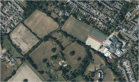
686.As noted in proceeding paragraphs, permissions are now largely in place for the residential development of the wider site known as KN2 (Land South of Knowle), which was proposed as an allocation in the 2020 plan. Part of the overall policy approach set out within the 2020 plan is that land would be made available for the expansion/redevelopment of Arden Academy to ensure sufficient space is available for both quantitative and qualitative improvements to facilities at the site. Comment
687.Following the withdrawal of the 2020 plan in October 2024 the Council worked with the respective landowner's/site promoters and an indicative land use masterplan was produced and consulted on in Autumn 2024. This was latterly endorsed at Cabinet in December 2024 and helped provide a basis upon which subsequent planning applications have been considered. This included the provision of 1.8 ha of land being identified for transfer to the Council, primarily in connection with the development of 200 dwellings on land west of Warwick Road[55]but also linked by way of condition to the other associated applications. In all cases this has been given significant positive weight when the applications were considered, helping support cases of Very Special circumstances. The Council remain in active engagement with all parties, and the land is expected to be formally transferred (on a phased basis) later this year. Comment
Broad Locations[56]
KN3 - Land around Dorridge Railway Station
688.NDMPs S5 (1)(h): Principle of development outside settlement and GB7 (1)(h): Development which is not inappropriate in the Green Belt, now support development within reasonable walking distances of railway stations and as such development consistent with these national policies can be expected to come forward in this settlement. This will include development around Dorridge station and as such it is included as a broad location in this plan. Comment
[55] Planning application reference 2025/00155.
[56] See Policy SMBC/HO2: Broad Locations for the policy wording relating to these areas.
