Draft Submission Plan (Regulation 19)
Hampton in Arden Comment
The Settlement Now
586.The parish area includes the rural settlements of Hampton-in-Arden and Catherine-de-Barnes, both of which are small villages east of Solihull, which are located in close proximity to major transport links joining Birmingham with Coventry. The settlements are divided by the M42 motorway and are broadly bounded by the A45 and A452 trunk roads to the north, by the River Blythe to the east and south and by the Grand Union Canal, Hampton Coppice and the A41 to the west Comment
587.The settlements are situated within the largely pastoral and historic Arden Landscape. This area of Green Belt which separates the wider Birmingham conurbation from Coventry Belt, is known as the ‘Meriden Gap. Comment
588.The central part of Hampton-in-Arden was first designated as a Conservation Area by Warwickshire County Council in order to preserve the historic core of the settlement. In 2015, Solihull MBC completed a review of the Conservation Area and expanded its boundaries to include other notable parts of Hampton-in-Arden. Comment
589.A neighbourhood plan for the parish was adopted in August 2017. Comment
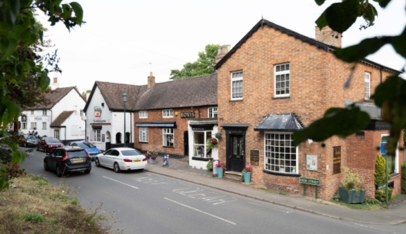
590.The parish currently covers the village itself and associated hinterland, and by virtue of boundary changes that took effect in April 2019, the parish boundary was extended westwards up to the urban edge and all of Catherine-de-Barnes is now included in the parish. Comment
591.The village of Hampton-in-Arden is located to the eastern side of the Parish whilst the smaller settlement of Catherine-de-Barnes is located to the western side. Between them, the settlements have a range of facilities including a primary school, a library, doctor’s surgery and a number of shops including a post office and chemist together with recreational facilities. Comment
592.Hampton-in-Arden has a railway station on the West Coast Mainline which provides access to London, Birmingham and Coventry. The station has a car park accommodating some 72 vehicles. A bus service runs through the village which connects Hampton-in-Arden to Meriden, Catherine-de-Barnes and Solihull Comment
The Settlement in the Future
593.Given the limited range of services, it is considered that development options are restricted to what would be proportionate extensions to the settlement. A key aspect to this is to ensure that the existing infrastructure supporting the village, especially the school, is not overwhelmed from additional demands that may occur from larger expansions. Comment
594.The M42, which separates Hampton-in-Arden and Catherine-de-Barnes, will continue to provide an important part of the strategic highway network. The ongoing improvements to Junction 6 of the M42 include a new road linking the motorway to the A45 via a new junction (junction 5a) located where Solihull Road currently crosses the motorway. The new road (A4545) was fully opened in June 2025. Comment
595.The HS2 line will run through the parish. To accommodate the crossing of the River Blythe (and its floodplain), a viaduct of some 480m in length and over 10m above ground level will be constructed. Comment
What is Required for the Settlements in the Future?
596.The parish area of Hampton in Arden will require protection from excessive development that may impact upon the character and attractiveness of the village; and the services it provides. Where development is provided, the following issues will need to be addressed. Comment
597.Community Infrastructure Levy – Presently, the parish council will directly receive 25% of the levy for developments occurring in the parts of the parish covered by the Neighbourhood Plan. Elsewhere, principally around Catherine-de-Barnes (which was a later addition to the parish), 15% of the levy will be passed onto the Parish Council. This will provide a significant source of funding that can be used to take forward appropriate projects that the community have identified as priorities. This can include simple, relatively low-cost actions (e.g. further traffic regulation orders) through to more substantial projects. It will be for the parish council to decide how this ‘local’ element of the CIL receipts is to be spent and there is potential for partnership working to maximise the use of monies from this source. Comment
598.Pedestrian and Cycling Connectivity – Enhancements to encourage and promote walking and cycling in the settlement, particularly towards the local centre, schools and public transport will be required. Developments will be expected to ensure that walking and cycling connectivity is provided both within and beyond the site boundary, linking in with the existing and proposed cycle and walking networks identified in the Council’s Cycling and Walking Strategy, as well as routes for recreation. Comment
599.Green Space Improvements – In accordance with the NPPF and the ‘golden rules’, opportunities for the provision and improvement of local green space that is accessible and of high quality will be maximised. Comment
600.Health provision – The Council is working with the BSOL ICB to establish the impact of new development on local GPs and other services, and how this can be addressed. Comment
601.Other necessary improvements to local infrastructure - Where development generates a need for new or improved infrastructure, developers will be expected to deliver such improvements to ensure that growth does not place unacceptable pressure on existing infrastructure networks and services and contributes to the creation of sustainable, well-served communities. Comment
Recent Planning Applications
602.A number of recent planning applications need to be highlighted as they are relevant to how the area will develop in the future, and they will have implications for determining what an appropriate amended boundary to the Green Belt ought to be. The proposals include the following: Comment
603.A resolution to grant outline planning permission for residential development on Land at Oak Farm was taken in May 2023 for up to 95 dwellings with associated infrastructure and open space. This site was an allocation in the 2020 plan known as HA2 Oak Farm, Catherine de Barnes. Comment
Existing Allocation
SLP Site 24 – Land off Meriden Road, Hampton-in-Arden
604.The adopted Solihull Local Plan (2013) allocated this site off Meriden Road for development of approximately 110 dwellings. Planning permission was granted for 96 dwellings which is currently under construction. Comment
Proposed Allocations
Policy SMBC/HA1: Meriden Road, Hampton in Arden Comment
- The site is allocated for 100 dwellings
- Development of this site should be consistent with the following principles:
- Retention of TPO trees and established hedgerows;
- Provision of public open space and play facilities at the heart of the development;
- Protection of the local landscape, ecology and drainage assets;
- Perimeter block development to maximise natural surveillance and encourage active streets and views over the countryside;
- Higher density housing reducing towards the edge of the Green Belt;
- Facilitating easy access by walking through the site and into the countryside.
- No development within any area of higher flood risk zones
- Provision of above ground SuDS features
- Likely infrastructure requirements will include:
- Financial contribution to education provision as required by the Local Education Authority;
- Developer contributions to primary and secondary care health services in conjunction with Birmingham and Solihull Integrated Care Board (BSOL ICB).
- Consideration to realigning the surface water flood risk within the site to continue in a west to east direction through the POS to the receiving floodplain;
- Appropriate measures to promote and enhance sustainable modes of transport including pedestrian and cycle connectivity towards Hampton in Arden rail station, shops and health centre;
- Financial contribution to provision of new playing pitches and contributions to enhancement of existing recreational facilities, to accord with the requirements identified in the Playing Pitch Mitigation Strategy.
Justification
605.This site sits adjacent to that allocated in the SLP 2013 and they should ideally be linked in a comprehensive manner. This will help improve connectivity between the new developments and maximise the effectiveness and efficiency of new infrastructure. It provides an opportunity to re-use the former ammunitions depot which is a brownfield site (and is included on the Council’s BLR). Open space provision serving the development as a whole will be an important consideration. Comment
606.The parcel of land immediately east of the village is a moderately performing parcel in Green Belt terms. The land has low capacity to accommodate change in the Landscape Character Assessment, 2016. The site has medium accessibility and is close to the rail station. A large part of this area is included on the Council’s BLR. Comment
607.The Level 2 Strategic Flood Risk Assessment identifies surface water flood risk within the site and highlights the opportunity for realigning the flood risk east to west through the area of green infrastructure. Comment
608.This allocation measures approximately 3.4 hectares. The site lies within the Arden landscape character area and is on the urban fringe. The site is well screened to the boundaries so views in are screened by existing vegetation although glimpses can be seen through the tree cover especially in the winter months Comment
Site SO1 – East of Solihull
609.Whilst this site is located within the Parish boundary of Hampton-in-Arden and Catherine-de-Barnes, it functions as part of the urban area rather than as an expansion of one of the parish’s villages. It is therefore not included within this chapter and is dealt with under the Solihull chapter. Comment
610.The capacity from this site, together with other allocations in this plan, and the site under construction from the SLP, will see over 1,000 dwellings being accommodated within the parish on allocated sites. Comment
Broad locations[54]
HA3 - Land around Hampton in Arden Railway Station
611.NDMPs S5 (1)(h): Principle of development outside settlement and GB7 (1)(h): Development which is not inappropriate in the Green Belt, now support development within reasonable walking distances of railway stations and as such development consistent with these national policies can be expected to come forward in this settlement. This will include development around Hampton in Arden station and as such it is included as a broad location in this plan. For the reasons outlined earlier in this chapter development associated with this broad location in particular will benefit from comprehensive masterplanning. Comment
[54]See Policy SMBC/HO2: Broad Locations for the policy wording relating to these areas.
