Draft Submission Plan (Regulation 19)
Blythe Comment
The Area Now
541.For the purposes of this chapter, the Blythe area comprises the parishes of Dickens Heath, Cheswick Green and Tidbury Green, which lie to the south of Shirley and the Stratford Road; and west of the M42. Comment
542.This area consists of distinct villages set within, and separated by, attractive countryside and Green Belt, which gives each village a sense of remoteness. The landscape is characterised by smaller hedged fields and numerous hedgerow trees of Arden pasture with the River Cole to the west and River Blythe SSSI from the south. Small ponds and pockets of ancient woodland punctuate the landscape. There are no Conservation Areas, but several farmhouses are Grade II listed buildings within a farmland setting. Comment
543.Tidbury Green comprises predominantly inter-war linear development along key roads. Recent residential developments at Tidbury Green Farm and Lowbrook Farm have provided a greater mix of housing types and much needed affordable housing to the area. Tidbury Green primary school has accommodated the pupils arising from these new developments. Wythall railway station, which has services to Birmingham and Stratford upon Avon, is within walking distance from the centre of the village, but bus services are poor. The south of the Parish borders the popular Earlswood Lakes and Clowes Wood SSSI. There is a railway station with limited services at Earlswood, but few amenities. Tidbury Green parish contains 2,373 residents in 755 households. Comment
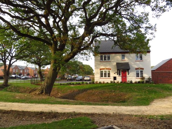
544.Cheswick Green is predominantly a planned new village from the 1970s and consists almost entirely of post-war development characterised by cul-de-sac, open plan layouts. There are a number of key local facilities, including a newly expanded primary school, GP surgery, village hall, pub and local shops. Public transport is via the bus service, which runs to Shirley and Solihull. Planning permission was granted at Cheswick Green Primary School to expand to a two-form entry school to accommodate pupils from new housing development at Blythe Valley Park and Mount Dairy Farm. The hamlet of Illshaw Heath lies to the south. Cheswick Green has a population of 4,405 residents in 1,393 households. Comment
545.The modern, multi-award winning village of Dickens Heath was ‘created’ in the late 1990s, guided by an architect-led masterplan. It has since undergone rapid expansion with a variety of architectural styles of development and a village centre. Whilst housing densities are higher around the village centre, the area has an attractive, mature woodland, a Country Park and canal side setting, with a few early cottages adding sporadic visual interest. Comment
546.The centre has a range of community facilities including a two-form entry primary school, library, GP surgery, shops and services. Due to limited land availability the school does not currently have scope to expand on-site. There is a railway station close to the village at Whitlock’s End, which benefits from a car park and two services per hour to Birmingham, however pedestrian and cycling access needs to be improved. Dickens Heath has a population of 4,969 residents in 2,136 households. Comment
547.Blythe Valley Park comprises a modern campus style commercial development within an attractive parkland setting. There are several award winning signature buildings providing a contemporary and sustainable working environment. A total of 750 homes and a care home at the southern end of the park have been built, which has created a new community and increased the diversity of housing types and tenures in the area. Close to Junction 4 of the M42, there is excellent access to the strategic road network, but limited bus services. Comment
548.As a whole, the villages benefit from some key facilities and Whitlock’s End Station has 2 services per hour to Birmingham and 1 service per hour to Stratford. However, the wider sub-area suffers from poor public transport provision with limited bus services between settlements, which perpetuates travel by private car. Comment
The Area in the Future
549.The area will be provided with affordable homes and market housing for a range of people such as families, young professionals and those wishing to down-size. Comment
550.Significant new development in the area will add to its vibrancy and vitality, whilst retaining the intrinsic character of distinctive villages separated by open countryside. Comment
551.Cheswick Green and Tidbury Green will be inset from the Green Belt in accordance with Policy SMBC/GB3. Comment
552.New and existing communities will be integrated and benefit from increased infrastructure provision and enhanced access to natural green spaces and the canal network. Comment
553.Improvements to local facilities, services and public transport will have been realised, encouraging more sustainable travel patterns and improved connectivity to surrounding communities. Comment
554.It is recognised that this area of the Borough has a complex pattern of settlements that are located both in close proximity to each other, but also close to the urban edge. Each has its own sense of identity, and this is reinforced by maintaining a reasonable separation between each settlement and/or the urban edge. It is important that adequate separation continues to be provided between these settlements to avoid them coalescing. Whilst some development is proposed in this area it does mean that the gaps between settlements that will remain are now more sensitive to change and it is important that they are protected so that they still provide an adequate separating function. Comment
What is Required for the Area in the Future?
555.Improved Public Transport – A higher population gives greater potential for improved public transport services to be viable, e.g. better frequency of bus services. Comment
556.Pedestrian and Cycling Connectivity – Cycling and walking links to Whitlock’s End station, village centres, local services and Shirley town centre will be improved to facilitate active travel and reduce car dependency, especially for short journeys. Comment
557.Highway improvements – It is likely that highway improvements will be required at various locations in the settlement, as well as capitalising on highway improvement initiatives along the Stratford Road. These could include speed reduction measures, access and junction improvements around development sites, highway capacity improvements or adjustments to traffic priority arrangements. Comment
558.Parking Improvements – The provision of appropriate additional off-street parking may be considered in Dickens Heath. Comment
559.New Primary School – Pupils arising from Site BL1 will be accommodated at Tidbury Green Primary school. A new two-form entry primary school will be required to serve the approved developments at ‘Land South of Dog Kennel Lane (former site BL2), The Green (former site 11) and BL3. The school is to be situated at ‘Land South of Dog Kennel Lane. Funding for the school will be expected via section 106 agreements associated with the development of the respective sites. Comment
560.New Secondary School and a Further Additional Primary School – Until this plan is adopted there will be some uncertainty about the overall level of growth that will come forward in this area. This uncertainty is principally because of the number and scale of speculative planning applications that have been submitted in the area. As these applications have not yet (all) been determined it is not yet clear whether the level of growth has or will trigger the need for additional education facilities over and above that identified in the preceding paragraph. This could include the need for a new secondary school and a further additional new primary school or school expansions. The Council will continue to monitor any further approvals of such applications and will if necessary, seek to identify a location for additional education facilities. Comment
561.Health provision – The Council is working with the BSOL ICB to establish the impact of new development on local GPs and other services, and how this can be addressed. Comment
562.Sports and Recreation - Replacement of any lost recreation / sports provision as a result of development will be required to an equivalent or better standard, including access and use by the wider community where appropriate. Several sites have been shortlisted in the vicinity of the existing clubs West of Dickens Heath. It has been identified that a sports hub to serve the new development in and around the settlement should be provided. This is set out under policy SMBC/D2. Comment
563.Play and Open Space - Provision of play and areas of open space within potential development sites will be required. There is also a need to ensure that best use is made of existing green and blue infrastructure assets within development sites, together with provision for linkages to the surrounding area. Comment
564.Green Space Improvements – In accordance with the NPPF and the ‘golden rules’, opportunities for the provision and improvement of local green space that is accessible and of high quality will be maximised. Comment
565.Community Infrastructure Levy – Presently the parish councils will directly receive 15% of the levy collected in the area. This will increase to 25% once any Neighbourhood Plans are adopted. This will provide a significant source of funding that can be used to take forward appropriate projects that the community have identified as priorities. This can include simple relatively low-cost actions (e.g. further traffic regulation orders) through to more substantial projects. It will be for the parish councils to decide how this ‘local’ element of the CIL receipts is to be spent and there is potential for partnership working to maximise the use of monies from this source. Comment
566.Affordable Housing – Affordable housing will be required on development sites in accordance with adopted planning policy. Comment
Proposed Approach
567.Given that the opportunities to develop on previously developed land in Blythe are extremely limited, Green Belt release will be required and a redefined Green Belt boundary will need to be established. In accordance with national planning policy, such boundaries should be defined clearly, using physical features that are readily recognisable and likely to be permanent. Sites that are close to the existing settlement or are / can be well-served by public transport will be preferable, subject to their performance against the purposes of including land in the Green Belt as supported in the Green Belt Assessment and any other evidence base and constraints. Comment
568.A mix of market and affordable housing, as well as smaller market homes for young people wishing to remain in the area and specialist housing to meet the needs of older people will be provided in the area. This will seek to align the types and sizes of homes to be made available and the needs of the community. However, there will need to be a careful balance struck between making the most efficient use of land and respecting the character of the local area. Comment
569.It is important that sites are considered in a comprehensive manner to avoid piecemeal developments occurring. This needn’t necessarily preclude a phased approach where one parcel of land or part of a site may be available for development in advance of another, but this should be in accordance with an approach agreed by the Council. Comment
Recent Planning Applications
570.A number of recent planning applications need to be highlighted as they are relevant to how the area will develop in the future, and they will have implications for determining what an appropriate amended boundary to the Green Belt ought to be. The proposals include the following: Comment
Development of up to 1,250 dwellings at Land South of Dog Kennel Lane.
571.Both a resolution to grant outline planning permission and an outline planning permission for this Green Belt site that was an allocation in the 2020 plan known as BL2 have now taken place (two separate planning applications[51]. This site in total will accommodate up to 1,250 dwellings and includes provision of land for a primary school, a care/retirement home and a commercial centre. Comment
Development of up to 86 dwellings at Land North of Tythe Barn Lane
572.A resolution to grant full planning permission[52]has now taken place for this Green Belt site that was the northern part of an allocation in the 2020 plan known as BL1. Comment
Development of up to 110 dwellings at Land West of Rumbush Lane
573.Outline planning permission[53] has now been granted for this Green Belt site to the west of Rumbush Lane, Tidbury Green. The site will accommodate up to 110 dwellings as well provision for a football pitch and associated infrastructure for Leafield Athletic FC. This site was not allocated in the 2020 and has come forward as a speculative development utilising Grey Belt land. It is applications such as this that contribute towards the short-term interim supply of Grey Belt land included in row 10 of the land supply table. Comment
Proposed Allocations
Policy SMBC/BL1: West of Dickens Heath Comment
- The site is allocated for 450 dwellings.
- Development of the site should include:
- Connection to proposed Dickens Heath to Solihull town centre cycle route.
- Provision of public open space, including children’s play in accordance with the Open Space Assessment and any future revisions.
- Relocation of the existing sports provision to a suitable site in the vicinity;
- Retention of Local Wildlife Sites, with potential for enhancement and appropriate buffer to Tythe Barn Coppice ancient woodland.
- Retention of trees and hedgerows within the site and along Tythe Barn Lane to conserve the character of this approach into Dickens Heath;
- Provision of suitable SuDS and flood risk management;
- On site accommodation for older people in accordance with Policy SMBC/HO5.
- 5% of open market dwellings to be provided in the form of Self and Custom Build Plots in accordance with Policy SMBC/HO4.
- Likely infrastructure requirements will include:
- Financial contribution to education provision as required by the Local Education Authority;
- Developer contributions to primary and secondary care health services in conjunction with Birmingham and Solihull Integrated Care Board (BSOL ICB).
- Relocation of the existing sports provision;
- Highway improvements as required including speed reduction measures and access improvements along Tilehouse Lane and Tythe Barn Lane.
- Provision of above ground SuDS features and deculverting of existing watercourse through site where feasible.
- Appropriate measures to promote and enhance sustainable modes of transport including pedestrian and cycle connectivity towards Dickens Heath and Whitlocks End Station in accordance with the Council’s LCWIP.
- Financial contribution to provision of new playing pitches and contributions to enhancement of existing recreational facilities, to accord with the requirements identified in the Playing Pitch Mitigation Strategy.
- To support sustainable development within the area, the site should be promoted in a comprehensive basis supporting the positively planned relocation of the existing sports facilities south of Tythe Barn Lane to alternative locations within the surrounding area. Until such time as these facilities are appropriately relocated or robust plans have been confirmed to secure a timely relocation that would prevent the closure of any associated clubs (either for a short period of time or permanently), development of the site will not be supported.
Justification
574.This allocation comprises of land to the west of the existing village. The site is bounded by Tilehouse Lane to the west, Tythe Barn Lane to the north and Birchy Leasowes Lane to the south. Comment
575.The site is currently occupied by Highgate United FC, Wychall Wanderers FC and Old Yardleians Rugby Football Club, and re-provision will be required for these sports pitches. Tythe Barn Meadows Local Wildlife Site (LWS) to the west will be retained, as will the integrity of Little Tyburn Coppice, a remnant ancient woodland. Tyburn Farm pastures have been confirmed as a LWS as part of the 2020 Local Plan Review process; it is the area north of Tythe Barn Lane running up to the canal. The LWSs are expected to impact upon the ability to re-provide the playing fields within the site and therefore alternative options for their re-provision is being pursued. Comment
576.The site is located in very close proximity to Whitlock’s End Station, which has 2 train services per hour to the centre of Birmingham with a short journey time of 20 minutes. Furthermore, local services and shops in Dickens Heath village centre will be easily accessible by foot or bicycle, and it is important that convenient links are provided. Comment
577.The Landscape Assessment (2016) states that the Blythe area has medium landscape value but high overall sensitivity to new development. As such, historic landscape features, such as hedgerows and standard trees, and the meadows and woodland designated as Local Wildlife Sites should be retained. Comment
578.Highway improvements will be required to the surrounding roads, and a connection to the pedestrian/cycling link north of the hedgerow along Tythe Barn Lane to provide a safe route to Whitlocks End Station. Comment
Policy SMBC/BL3: Whitlock’s End Farm Comment
- The site is allocated for 450 dwellings
- Development of the site should include:
- Respecting the setting of the Grade II Whitlocks End Farm.
- Provision of public open space and a range of play areas for children and young people in accordance with the Open Space Assessment and future revisions.
- Enhancement of public rights of way through the site as a pedestrian route and key green infrastructure link.
- Trees and hedgerows along bridleway and public rights of way to be retained.
- On site accommodation for older people in accordance with Policy SMBC/HO5.
- 5% of open market dwellings to be provided in the form of Self and Custom Build Plots in accordance with Policy SMBC/HO4.
- Likely infrastructure requirements will include:
- Developer contributions to new 2-form primary school and early years provision at ‘Land South of Dog Kennel Lane’ (former Site BL2 from 2020 withdrawn Local Plan).
- Developer contributions to primary and secondary care health services in conjunction with Birmingham and Solihull Integrated Care Board (BSOL ICB).
- Provision of above ground SuDS features.
- Avoidance of flood risk areas to north –west of site and potential for flood alleviation measures to benefit the wider area.
- Highway improvements as required including access improvements on Bills Lane.
- Appropriate measures to promote and enhance sustainable modes of transport including improvement of bus services and pedestrian and cycle connectivity towards Shirley railway station, the Stratford Road and Shirley Town Centre in accordance with the Council’s LCWIP.
- Financial contribution to provision of new playing pitches and contributions to enhancement of existing recreational facilities, to accord with the requirements identified in the Playing Pitch Mitigation Strategy.
Justification
579.Site BL3 will extend towards the western edge of the Borough where the boundary is marked by the Stratford railway line, and being on an embankment at this point the rail line itself will help provide visual separation between the new development and the built-up area of Major’s Green to the west (which is in Bromsgrove District). Comment
580.The site is located within easy walking distance of Shirley station and is accessible to Shirley Town centre by walking and cycling. Comment
581.Site BL3 provides for a narrow front of the amended Green Belt boundary where only the minimum separation between the urban edge and Dickens Heath is provided (by shifting development to the west thus being ‘off set’ from the built-up area of Dickens Heath). Furthermore, it avoids further development in the gap between the urban edge and Dickens Heath along Dickens Heath Road, which is the principal route south from the urban edge to the village – as such, this is where the perception of the gap should be at its greatest. Comment
582.The site is located in a Green Belt parcel that scores moderately (Green Belt Assessment 2026), and it is considered that this represents a trade off with the higher accessibility of the site being located on the urban edge close to where need arises. Comment
583.Most forms of development in this area will reduce the gap between the urban edge and Dickens Heath. This will be reduced to approximately 300m (from 600m) and this should be seen as the minimum necessary to provide a meaningful gap provided it only occurs over a narrow front (i.e. just a pinch point) rather than over a broad front that simply results in a uniform corridor like gap between the urban edge and Dickens Heath. Comment
584.Development would allow the retention of land as open and accessible space south of the site with access improvements to the open countryside further south Comment
Broad Locations
BL4 - Land around Shirley, Whitlock’s End, Wythall and Earlswood Railway Stations
585.NDMPs S5 (1)(h): Principle of development outside settlement and GB7 (1)(h) Development, which is not inappropriate in the Green Belt, now support development within reasonable walking distances of railway stations and as such development consistent with these national policies can be expected to come forward in this settlement. This will include development around stations at Shirley, Whitlocks End, Wythall and Earlswood and as such these are captured as part of the respective broad location in this plan. Although Wythall station is located within Bromsgrove District, it is located close to the Borough boundary such that parts of Solihull Borough are within a reasonable walking distance of the station, and thus it is included as a broad location. Comment
[51] Western side of the site (700 dwellings) has a resolution to grant under reference 2024/02926 and the eastern side of the site has a planning permission in place (for 550 dwellings) under reference 2024/00598.
[52] 2024/00728
[53] 2025/01502
