Draft Submission Plan (Regulation 19)
Solihull Town Centre & Mature Suburbs Comment
The Area Now
742.Solihull Town Centre is a strong, vibrant and regionally important Centre containing a wide variety of shops, businesses and civic services. The ‘mature suburbs’ area that forms part of the urban area includes the largely residential suburbs of Elmdon, Hillfield, Lyndon, Monkspath, Olton, Shirley, and Solihull. These areas benefit from good schools and strong local centres. Comment
743.The Mature Suburbs adjoin Birmingham to the west and north, with countryside that is part of the Meriden Gap and the M42 to the east, and Green Belt to the south. Comment
744.The Mature Suburbs are characterised by Victorian and Edwardian development, the Grand Union canal and railway network, a tighter urban grain, extensive gardens and parks. There are also substantial recreational facilities, such as Olton, Robin Hood and Widney Manor golf clubs and Olton Mere. More modern housing estates are characterised by an open plan, cul-de-sac layout with on-plot parking and a predominance of detached and semi-detached properties. Shirley Town Centre provides for much of the needs of the west of the area, and has benefitted from significant investment at its heart, whilst there are district centres at Hobs Moat, Hatchford Brook, Shelly Farm and Olton. This area is home to a variety of employment opportunities located in the Solihull and Fore Business Parks and JLR, as well as in the established Cranmore and Monkspath area. Comment
745.Solihull Town Centre is enriched by its attractive historic core of St. Alphege church, the Square and the High Street, and contains retail, commercial and cultural facilities. To the north and south of the Town Centre, the more modern retail developments of the 1960s precinct style Mell Square and the early 21st Century Touchwood development broaden its offer. To the south and east lie Malvern and Brueton Parks, which provide extensive areas of land for informal recreation within walking distance of the Town Centre. Tudor Grange Park to the south-west provides opportunities for more formal sport and recreation. Comment
746.Both the 2006 UDP and 2013 SLP identified large scale development opportunities for Shirley town centre that made provision for significant new residential development to be provided. The Parkgate scheme opened in 2014, and redevelopment of the Powergen site is now complete. Comment
747.There is an extensive educational campus to the south-west of Solihull Town Centre containing Alderbrook, St Peter’s and Tudor Grange secondary schools, together with Solihull College. Immediately to the north of the Town Centre is Solihull School. On the edge of the Mature Suburbs to the south of the Town Centre is the Sixth Form College. These establishments are located within walking distance of Solihull Town Centre. The north of the area is catered for by Lode Heath and Lyndon schools, whilst Langley and Light Hall schools provide secondary education in the west and south. Many of the schools suffer from traffic congestion at opening and closing times. Comment
748.Solihull has a transport interchange at the Western edge of the town centre which has a bus interchange and rail services to Birmingham, Leamington Spa and London, together with the Borough’s main bus interchange. This rail line also serves Olton and Hillfield/Monkspath at Widney Manor. There is also a rail station west of Shirley with services to Birmingham and Stratford. Comment
The Area in the Future
749.The Mature Suburbs are substantially developed with few opportunities for significant growth. Being mainly residential, there are relatively few brownfield land opportunities. The Town Centre, which has grown significantly for a generation, is likely to experience some restructuring with opportunities for a wider range of uses including residential. Comment
What is Required for the Area in the Future?
750.There are limited opportunities for growth in the Mature Suburbs reflecting the built-up nature of the area, and the importance of maintaining the attractive open spaces that are so important to the Borough’s character and well-being. Comment
751.Restructuring of Solihull Town Centre – The 2020 Solihull Town Centre Master plan highlighted opportunities for alternative uses whilst ensuring that sufficient land is retained for retail and commercial uses. The masterplan highlights the potential for the identified opportunity sites to accommodate significant levels of residential development, and there are likely to be other windfall sites that come forward as the town centre evolves. Comment
752.Large scale redevelopment proposals at Mell Square have now got the benefit of planning permission and the development to be known as Holbeche Place is expected to commence before the end of the year. Comment
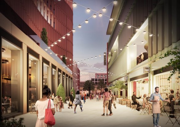
753.Improving accessibility to and around Solihull Town Centre - A key challenge will be to manage the anticipated increase in traffic in the area, especially around Solihull Town Centre and the major road corridors. The Council is undertaking studies looking at key junctions within and close to the Town Centre. However, encouraging more people to use public transport, cycling and walking, rather than the private car for journeys to the Town Centre will be essential. Improving routes to/from the Town Centre and links to the adjacent parks for cyclists and pedestrians would help to make these alternative modes of travel more attractive. Comment
754.Development Opportunities in Shirley Town Centre – Following completion of the Parkgate development and redevelopment of the Powergen site, there are limited opportunities for further large-scale developments, and therefore any further residential dwellings are likely to arise from windfall developments. Comment
755.Re-use of Land allocated for Business/Retail Purposes – There are areas of older industrial estates that may be recycled for new uses, such as at Cranmore to the west and Lode Lane to the north. Most of the available land for business use has been developed, and some business areas may be available for alternative uses. Comment
756.Sports and Recreation - It has been identified that a sports hub to serve the new development in and around Solihull should be provided. This is set out under policy SMBC/D2. Comment
757.Health provision – The Council is working with the BSOL ICB to establish the impact of new development on local GPs and other services, and how this can be addressed. Comment
758.Community Infrastructure Levy – Presently in areas like the Mature Suburbs and Solihull Town Centre which are not covered by a town or parish council,15% of the collected funds will be spent in the area. The Local Authority will engage with the local community and agree with them how best to spend the funding. This can include simple relatively low cost actions through to more substantial projects. Site SO1 is dealt with in this chapter, as it functions as an extension of the urban area, but as noted elsewhere, the area is located within Hampton in Arden parish and therefore the Parish Council will directly receive a proportion of CIL from the site. Comment
759.Provision of affordable housing – This will be challenging given the lack of significant opportunities for new housing in the Mature Suburbs. However, opportunities for housing will be identified through the refreshed Town Centre Master plan and the urban extension to the east, which will provide a proportion of affordable housing. Comment
Proposed Approach
760.Whilst significant retail or commercial growth in the Town Centre is unlikely, retaining the existing Town Centre boundary will provide opportunities for a broader range of uses. Given that the Town Centre is the most accessible location in the Borough, it will be important that uses that attract significant numbers of visitors will be able to find sites there. However, there are likely to be opportunities for significant residential or mixed residential and commercial uses. Higher densities can be accommodated as owning a car in this highly accessible location will not be essential. Comment
761.A mix of market and affordable housing, as well as smaller market homes for young people wishing to remain in the area, and specialist housing to meet the needs of older people will be provided in the settlement. This will seek to align the types and sizes of homes to be made available and the needs of the community. However, there will need to be a careful balance struck between making the most efficient use of land and respecting the character of the local area. Comment
762.Some of the sites, in particular site SO1 (East of Solihull), have multiple and potential complex land assembly issues. It is important that sites such as this are considered in a comprehensive manner to avoid piecemeal developments occurring. This needn’t necessarily preclude a phased approach where one parcel of land or part of a site may be available for development in advance of another, but this should be in accordance with an approach agreed by the Council and all relevant landowners/development promoters. This will include joint responsibility for the provision of infrastructure, and this latter point will also be relevant to other sites around the village which also need to ensure they contribute towards the provision of the required infrastructure. Comment
Proposed Allocations
Policy SMBC/SO1: East of Solihull Comment
- The site is allocated for 770 dwellings.
- Development of this site should be broadly consistent with the following principles:
- Preserving the setting of the Grade II listed Field Farm and 239 Lugtrout Lane. Development should be set back from the immediate locality to avoid harm. Only if harm cannot be avoided should mitigation be considered, and then it should be fully justified and demonstrated to be successful in reducing harm;
- Provision of public open space and a range of play areas for children and young people in accordance with the Open Space Assessment and future revisions. Any formal play features will need to be sympathetic to the historic setting of Field Farm and 239 Lugtrout Lane;
- Retention of existing sports pitch.
- On site accommodation for older people in accordance with Policy SMBC/HO5
- 5% of open market dwellings to be provided in the form of Self and Custom Build Plots in accordance with Policy SMBC/HO4.
- Likely infrastructure requirements will include:
- Financial contribution to education provision as required by the Local Education Authority;
- Developer contributions to primary and secondary care health services in conjunction with Birmingham and Solihull Integrated Care Board (BSOL ICB).
- Highway improvements as required including speed reduction measures and access improvements along Damson Parkway and Lugtrout Lane
- Appropriate measures to promote and enhance sustainable modes of transport including pedestrian and cycle connectivity towards Solihull Town Centre and Elmdon.
- Financial contribution to provision of new playing pitches and contributions to enhancement of existing recreational facilities, to accord with the requirements identified in the Playing Pitch Mitigation Strategy.
Justification
763.This allocation takes the form of an urban extension close to Solihull Town Centre. It will be located on land to the rear of the ribbon development that fronts the northern side of Hampton Lane. As a revision to the site put forward in the previous plan, the northern boundary of the site is now intended to be formed by the Grand Union canal. This will enable the land between Lugtrout Lane and the canal to come forward for development, reflective of a recent planning consent granted for 50 dwellings in 2026[58]. The eastern boundary of the site will be formed by Field Lane. Comment
764.The allocation lies within the Green Belt, and it is immediately adjacent to the built-up area of the settlement and would represent a continuation of the existing developed area. The site lies within a parcel of moderately performing Green Belt and is influenced by built development either within the site, or in the immediate vicinity to the site. The site is relatively well-contained, and a defensible Green Belt boundary could be provided using the Grand Union Canal and Field Lane. Comment
765.The site performs well in terms of accessibility to all key services and facilities, as well as public transport and the scale of any proposed development could see public transport improvements secured. Comment
766.The Landscape Assessment (2016) states that the area on the fringe of Solihull has medium landscape value and medium overall sensitivity to new development. Careful mitigation of Heritage assets is required for the site, including the Grade II Listed Field Farm and 239 Lugtrout Lane. Development will need to consider these assets in the design of any future scheme. Comment
767.Playing pitches on the site are currently occupied by Coldlands Colts Boys FC and will need to be retained. Comment
768.This site appears in the Solihull chapter as it functions as an extension to the urban area, but it should be noted that it falls within the parish of Hampton in Arden. Comment
Policy SMBC/SO2: Moat Lane Depot Comment
- The site is allocated for 99 dwellings.
- Development of this site should be broadly consistent with the following principles:
- Provision of public open space and a range of play areas for children and young people in accordance with the Open Space Assessment and future revisions.
- An integrated drainage, landscape and ecological strategy should be developed for the site, which seeks to remedy the drainage is issues on the site as an opportunity to enhance place-making
- Likely infrastructure requirements will include:
- Financial contribution to education provision as required by the Local Education Authority;
- Developer contributions to primary and secondary care health services in conjunction with Birmingham and Solihull Integrated Care Board (BSOL ICB).
- Appropriate measures to promote and enhance sustainable modes of transport including pedestrian and cycle connectivity towards Solihull Town Centre
- On site doorstep play facilities
- Surface water flood mitigation including an integrated drainage, landscape and ecological strategy, seeking to support place-making on the site.
- Financial contribution to provision of new playing pitches and contributions to enhancement of existing recreational facilities, to accord with the requirements identified in the Playing Pitch Mitigation Strategy.
Justification
769.This brownfield site is located in the urban area and is formed from the existing Council depot and industrial estate, which are expected to become available during the Plan period. The site performs well in terms of accessibility to all key services and facilities, as well as public transport. Comment
Broad Locations[59]
SO3 - Land around Widney Manor Station
770.NDMPs S5 (1)(h): Principle of development outside settlement and GB7 (1)(h) Development which is not inappropriate in the Green Belt, now support development within reasonable walking distances of railway stations and as such development consistent with these national policies can be expected to come forward in this settlement. This will include development around Widney Manor station and as such it is included as a broad location in this plan. Comment
[58]PL/2024/00037/PPOL – approved July 2026
[59] See Policy SMBC/HO2: Broad Locations for the policy wording relating to these areas.
